JAN 20, 2023
Project starts
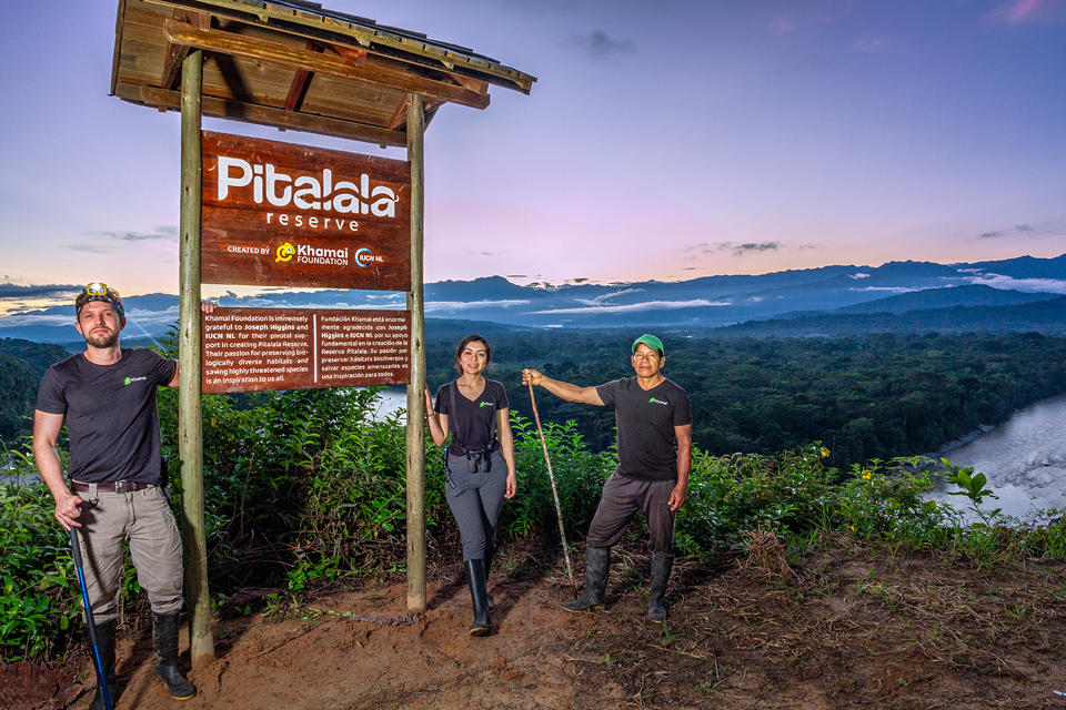
The fundraiser for the Pitalala Reserve is officially launched. This allowed the team of Khamai Foundation to begin the fieldwork and the buy-sell negotiations.
- Buy-sell negotiations begin.
- Fundraiser seeded by five backers.
- Preliminary exploration of land lots.